Grand Canyon / Havasu Falls April 2004
This page contains the gif images of the various topo maps made
The Sedona / Redrocks State Park Map can be found on the Sedona
Page
For all of these maps, you should be able to save the image itself.
For the Canyon itself, first an overview
The thick red track is our hike to and from the parking lot to camp. The road to the parking lot is the one that starts in the lower left corner at Frazier Wells.
The National Park itself is in red, and you can see where the South
Rim Village is, called "Grand Canyon" on this map, and quite a distance
even as the crow flies from Supai.
An overview at the hike at the 100K map series

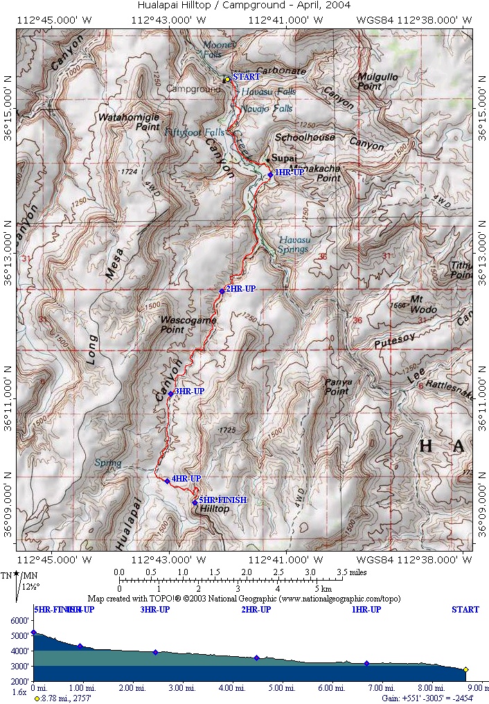
I did not have good times in, but did have good times out, and I took
the longest, so this is an upper bound on hike time.
This is from the highest magnification of maps, the 7.5 minute series and shows from the parking lot to about halfway
and the rest of the hike in at this mag.
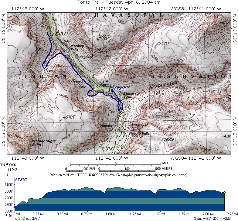
Day 2 - Hikes on the Tonto Trail
I was not actually on the whole hike, so if one of the group who was on the hike an tell me if I estimated the hike correctly, I would appreciate it.
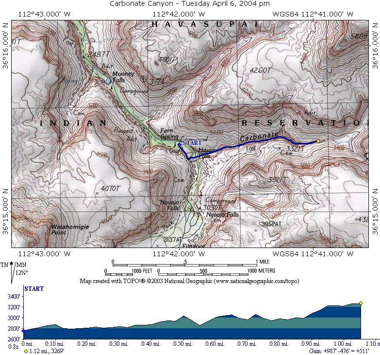
The afternoon was a hike up Carbonate Canyon:
I probably have this hike going further than we actually went.
Day 3 - Full day hike to Beaver Falls
Looks like we just reached the National Park on the hike.
Unless otherwise noted, all pictures posted from these trips were taken by either Don, Marina, or other members of the trip All rights to these pictures are reserved.
This page maintained by Don Samuels, don at snowedunder.com
This page last updated 04/16/2004


