Summit County's home page from whence this can be launched is: http://www.co.summit.co.us.
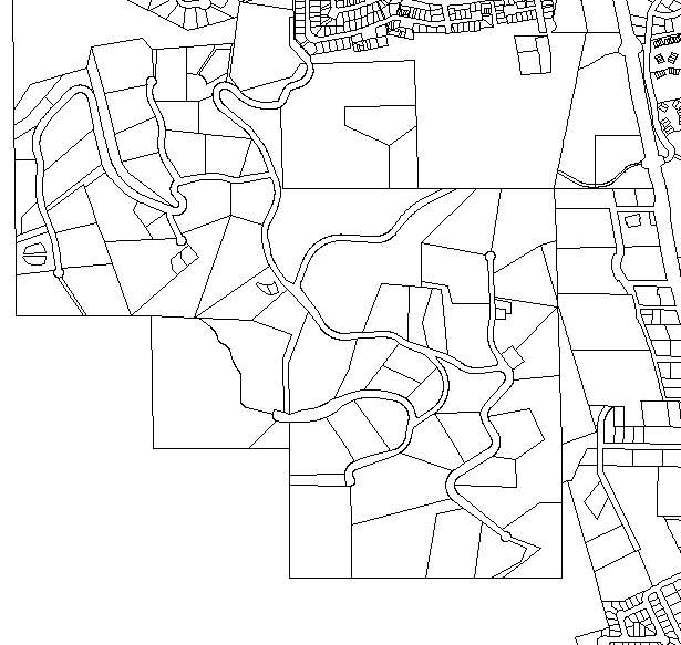
The interactive map can create quite nice maps of areas that you are interested in. For example here is Ruby Ranch and the surrounding area:
Compare this to the map that I generated with my CAD system, and a paper copy of the map of the ranch and graph paper.
I wanted to see how I could get this to overlay a USGS Topo map, so
I first brought up my Wildflower Topo maps that I use on my hike
pages and created the following bitmap:

I then used Corel Trace to turn the GIS bitmap to a vector format, and used Corel Draw to overlay that on top of the topo image:
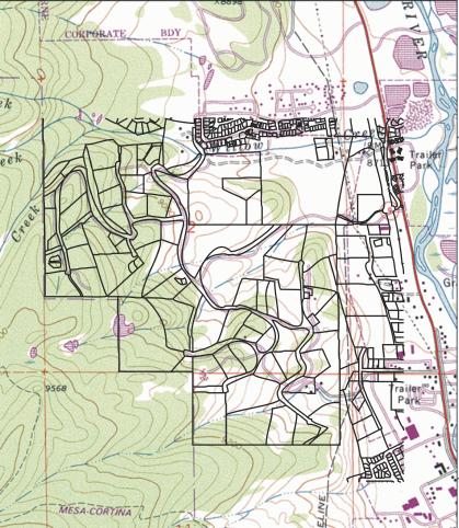
As you can see, the scales are not perfect for the overlays, and I don't know which is off, USGS or Summit County.
A larger version can be had by clicking here
This page authored by Don Samuels
Return to Snowedunder Home
This page last revised on April 28, 2001 at 3:15 pm MDT
Maps are derived from copyrighted material from Summit County (gis map)
and Wildflower or TOPO! (the topo maps) and the combined map, I will put
a copyright of Don Samuels on (2001).