Ute Peak via Acorn Creek July 4, 2008
Distance: 4.71 miles one way
Times:
Up: 5 hours 12 minutes (slow)
Return: We took a bad "short cut" so no times
Hikers: Don, Marina
Rating: More Difficult
Gore Range Outfitters
runs trail rides most of the way up this trail
Hiking poles are a must.
Topo:
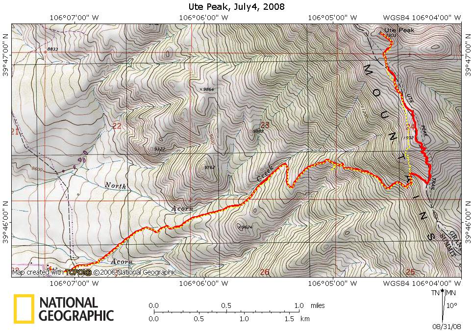
(red is ascent, yellow is descent )
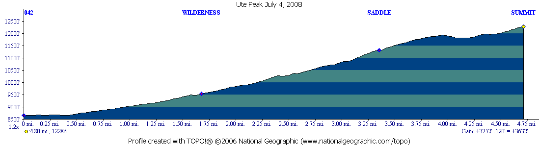
The profile:
kml file of ascent (requires Google
Earth) I am having trouble having this link launch, so if it does
not launch for you, then save the file and launch from your PC
We choose to summit Ute Peak from the Acorn
Trail route rather than Ute Pass road.
I screwed up and did not save the topo tracks in a way that gets the
times. However certain landmarks I did way point. Marina and I were in
much better shape than in 2007 when we did the Acorn hike as we made
the saddle an hour faster.
This time, the bugs in the lower valley were really bad compared to
June of last year. As hot as it was, long pants and sleeves were
a must. But to balance out the bugs, the Columbines were out in force.
I will leave the description of the hike up to the saddle to the
previous Acorn Creek Hike.
We left the saddle heading more or less north and climbed to the summit
of the first false peak, at first following a trail, but then the trail
disappeared so we just switchbacked to this summit. We then
basically continued to follow the ridge hitting a couple of additional
false summits. The trail leaves the Ptarmigan Peak Wilderness. Just
before tackling the real summit, we stopped for lunch, and then left
are back packs and obtained the real summit.
On the way back down, we tried to avoid the first false summit and
ended up in a bowl of loose dirt and scree. We had to be careful
working our way down. The net is although it may have been shorter and
did not have the ascent back to the first false summit, it was slower
and much more difficult. The descent is shown in yellow on the
topo.
I will get flowers up at some point.
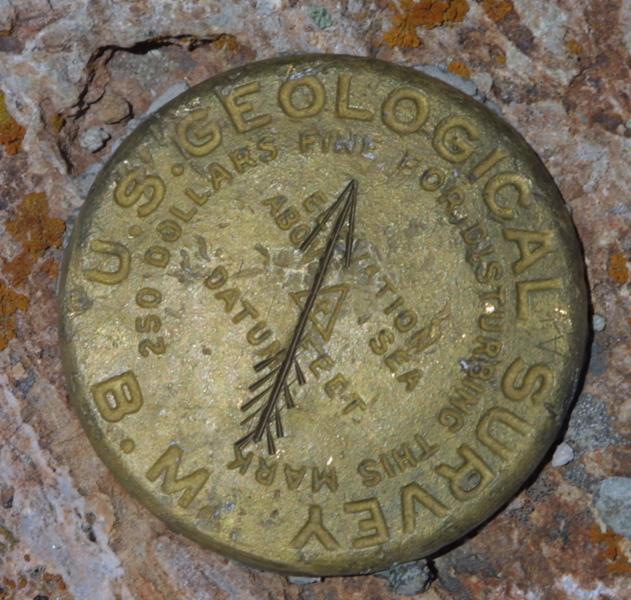
Here is a picture of the benchmark at the summit:
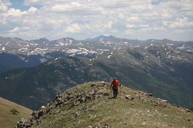
Marina made the summit before me as I was taking pictures of a small
patch of Columbines. Here I am, with Greys & Torres right
above my head.
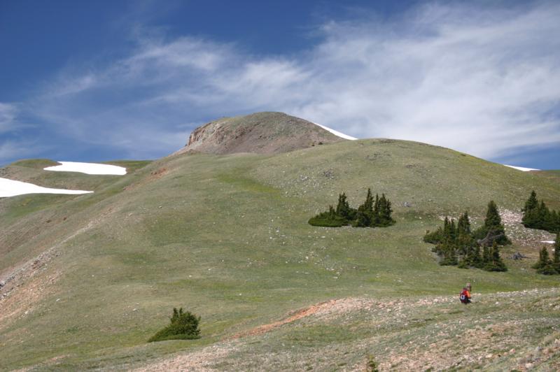
Marina took this picture on our way down. The summit is seen in the
upper center. I am next to the Ptarmigan Peak Wilderness boundary sign.
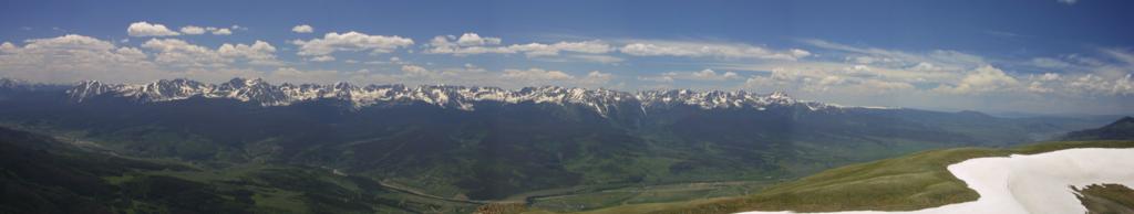
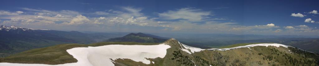
Stitched panoramas
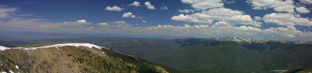
Looking South:
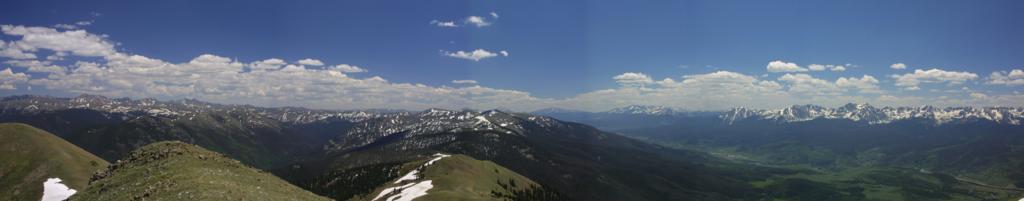
Looking west showing the Gore Range:
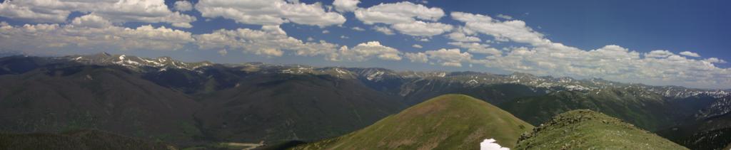
Looking north:
Looking northeast
and looking east:
Feedback to:

Back to Hikes Page
Back to Snowedunder Home
This page last updated September 8, 2008