Sniktau July 4, 2005
Don and Marina
Distance: Approximately 3.5 mile round trip
Duration: Approximately 4 hours including lunch
Mt. Sniktau is a 13er that is reached from the top of Loveland Pass, so
you are starting at 11,990 feet. The hike is totally above tree-line.
Even in July, expect to have extra clothing that is warm and wind
resistant. I needed my headband and gloves.
The hike leaves the pass on the "east side" of US6. If coming up
from I-70, this would be on the left side of the road at the summit of
the pass.
This is a deceptive hike in that there are a number of false peaks. In
fact, you can't really see the real peak until the last of the false
peaks.
The hike is profiled as follows:
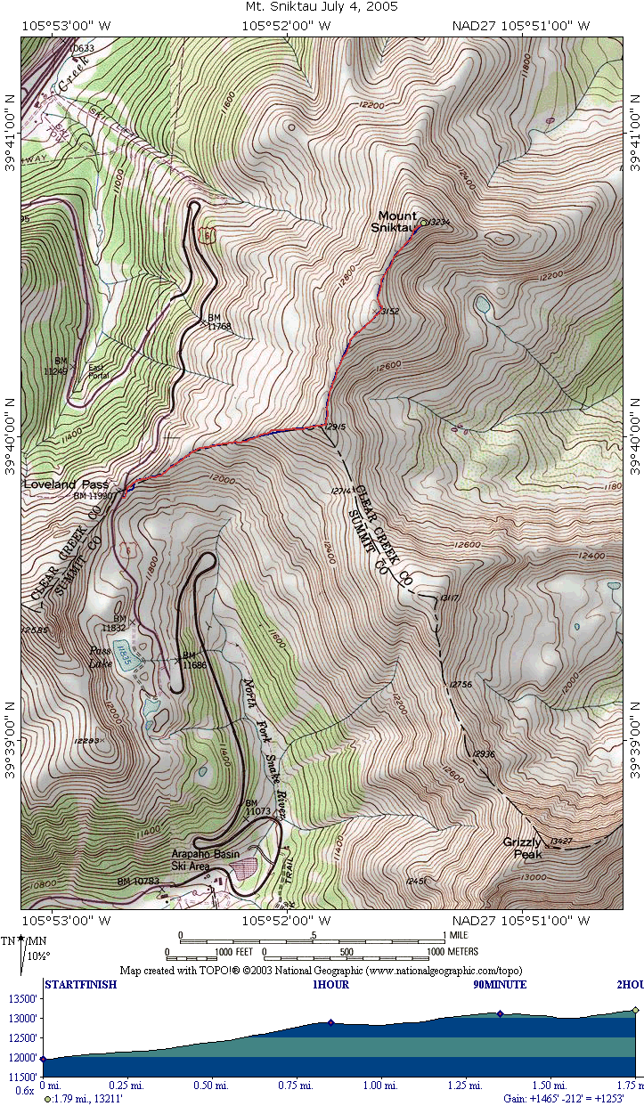
The hike starts up with a wide path of loose dirt. The hike to the
first false peak is the steepest portion of the hike. At the first
false summit, there is a wind shelter built up out of the loose rock.
Here the trail divides into 2, with the right branch heading towards
Grizzly Peak, and eventually Greys and Torries. The left branch is what
you want to take you to Sniktau summit.
Leaving the first false summit, a short hike and a quick climb brings
you to the first scree field. At the top of this field the 2nd false
summit is visible. There is a very slight drop in elevation before
ascending to the 2nd false peak (this does not show on the profile).
After the 2nd false peak, the real peak is visible, with a more
significant drop in elevation between the two peaks. Both peaks, are
above 13,000 feet. The scramble to the real peak is not as steep as the
hike to the first false summit.
We make the summit in 2 hours with only short breaks for snack bars. We
ate lunch on the way back down on the 2nd false summit.
The camera I was using was one I was not familiar with, and I did not
get as many pictures as I thought I took. This is too bad as the
wildflowers were probably at their peak for our hike.
Here are the pictures that I did get
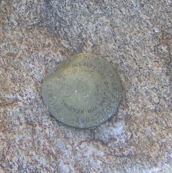
First, the USGS marker indicating the summit
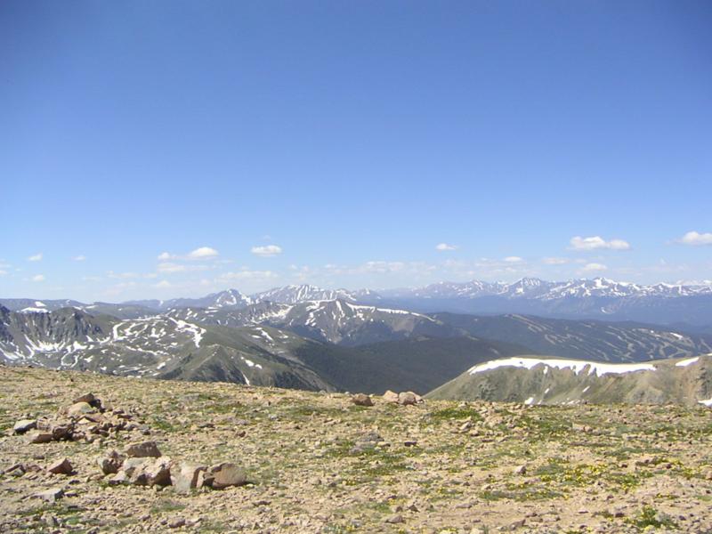
Looking over Keystone towards Breckenridge:
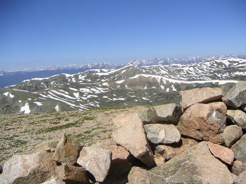
and looking over to Buffalo and Red
Back to Hikes Page
Back to Snowedunder Home
This page last updated July 5, 2005