Page updated August 30, 2002 using Topo-Colorado software to combine maps
Total Distance 12.1 miles by GPS, 11.46 by Wildflower Topo
Total Time 9 hours 45 minutes
Wildflowers
from this hike can be seen here. Erika kindly identified them for me.
I have made three maps, each to print on a full 8.5 by ll page. The route shown is fairly accurate on the east side, as I borrowed from our Eccles Pass Hike. The west side is approximate. My use of the gps has improved greatly since 1999.
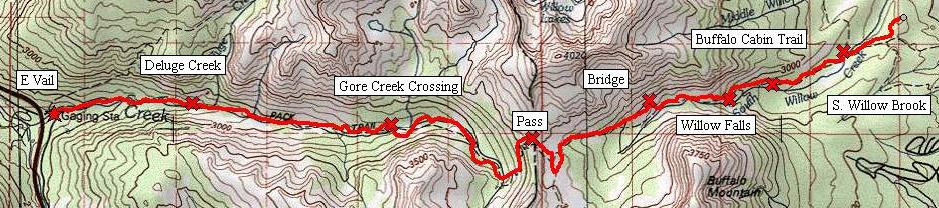
The full map at the 100K Topo series. I have included the profile on this map. I have reversed the profile so it is parallel to the map (in other words mile 0 is in Vail).
Here is a reduced view:
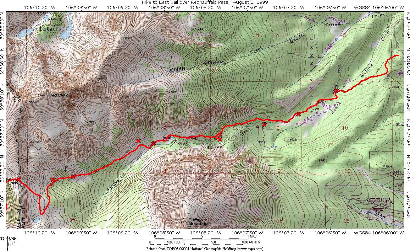
The east map in the 7.5 minute series
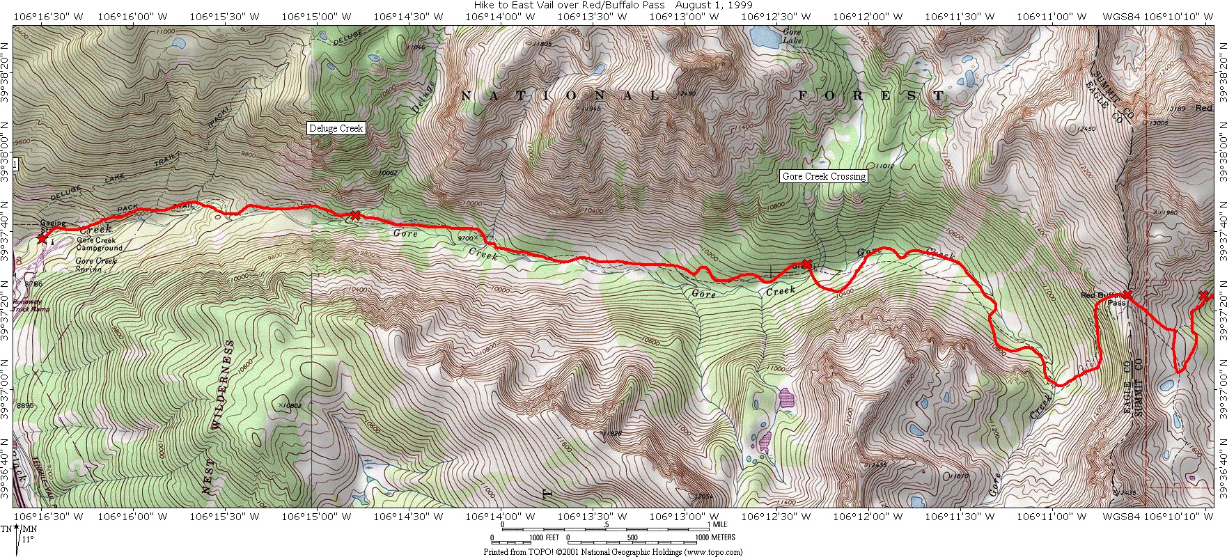
The west map in the 7.5 minute series.
Here is the table of waypoints and other useful information:
| Waypoint | Description | Latitude | Longitude | Mileage | Elevation |
| HOME | 1228 Emerald Road | 39.642888 | -106.101982 | 0 | 9389 |
| MESACO | Junction with Mesa Cortina | 39.639477 | -106.103404 | 0.2 | 9461 |
| SWILLO | Bridge over South Willow | 39.637240 | -106.112571 | 0.78 | 9360 |
| 1STMEA | 1st Meadow | 39.633452 | -106.120205 | 1.31 | 9491 |
| BUFTRA | Junction with Buffalo Cabin | 39.631805 | -106.127238 | 1.7 | 9583 |
| WFCAB | Willow Falls | 39.629375 | -106.136132 | 2.26 | 10003 |
| RBBLD | Boulder Field | 39.628951 | -106.149457 | 3 | 10406 |
| BRIDGE | Bridge | 39.629171 | -106.152397 | 3.25 | 10639 |
| RBST1 | Stream | 39.623668 | -106.165669 | 4.04 | 10971 |
| RBST2 | Stream | 39.623308 | -106.169590 | 4.27 | 11177 |
| RBEP? | Eccles Pass Junction | 39.619693 | -106.172175 | 4.58 | 11420 |
| RBPASS | Red Buffalo Pass | 39.623276 | -106.176531 | 4.91 | 11732 |
| RBCAMP | Camp Ground | 39.623550 | -106.202924 | 7.4 | 10186 |
| RBGCX | Gore Creek Crossing | 39.625390 | -106.205526 | 7.53 | 10167 |
| RBPOND | Pond | 39.625438 | -106.219763 | 8.31 | 9950 |
| RBSBRO | Sun-Bath Rock | 39.628227 | -106.242975 | 9.64 | 9501 |
| RBDLCR | Deluge Creek Crossing | 39.628903 | -106.246607 | 9.82 | 9445 |
| RBVAIL | East Vail Trail Head | 39.627230 | -106.274915 | 11.46 | 8700 |
Here is the waypoint file.
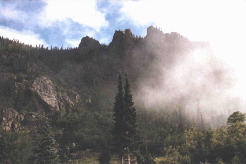
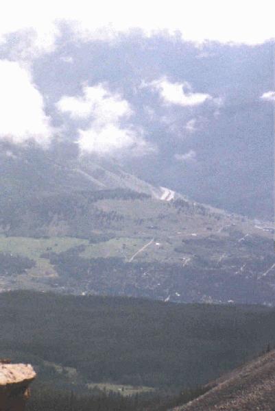
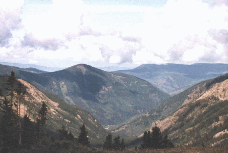
We left our house at 6:45 am and hiked on the Ruby Ranch Spur to the Mesa-Cortina. For those of you reading this not living on or visiting as guests at the Ranch, you will have to find other access to the Mesa-Cortina. The Mesa-Cortina from this point to its end at the South Willow Brook is an old jeep road from the ranch. The morning and early afternoon was characterized by low clouds, so the pictures we took were not the ideal scenic pictures. Examples of what the morning was like can be seen here and here.
There is very little elevation gain for this portion of the hike. The
trail is well traveled, with access points from the South at the Mesa-Cortina
trail head, Ruby Ranch, and the Willowbrook development. Traveling to the
South Fork, you may encounter muddy spots, especially at the following
locations: 1) right after the Ruby Ranch Spur meets the Mesa-Cortina (this
is also where the Willow Brook trail comes in) and 2) just before the South
Fork of Willow Brook. The bridge crossing the brook is a three log bridge,
which our dogs negotiate without difficulty.
Immediately after the bridge, the Mesa-Cortina trail ends and becomes
the Gore Range Trail. A sign will mark this, with a narrow trail coming
in on your right. If you go right, you hike north on the Gore Range trail,
paralleling Colorado Route 9. The hike to Salmon Lakes went this way. Our
hike continues straight on the old jeep road.
After a brief climb away from the creek, the path levels out. After
1.31 miles you will arrive at the first meadow. On your left will be Buffalo
Mountain and on the right Red Mountain. After going through a couple of
more meadows, the trail narrows to a footpath and you arrive at the Buffalo
Cabin trail on your right.
At this point the trail starts to climb. It passes a couple of small
springs / creeks, a scree field, coming at last to the Willow Falls area.
The remains of a foundation of a log cabin mark this area, and the falls
are about 20 yards beyond. This is at mile 2.26.
Assuming that you don't want to go to the falls (a popular destination
on the weekends), just before you come to the log cabin, the trail will
take a 90 degree turn to the right and start to climb again. Most people
will miss this turn. A tree on the left (not right) has a blaze on it.
Also there may be a piece of red yarn hanging down from a tree on the right
marking the turn. Look for it right in front of you. I will get pictures
of the hike to the falls at a later date, along with a falls write-up.
Now that you have found the trail (don't worry, you will lose it again
later on), it continues to climb through a couple of switch-backs. The
creek will occasionally be visible on your left. The trail continues alternating
between woods and meadows. At 3 miles, a boulder field will be on your
right and in order to avoid it the trail heads towards the creek and passes
through Pussy Willows.
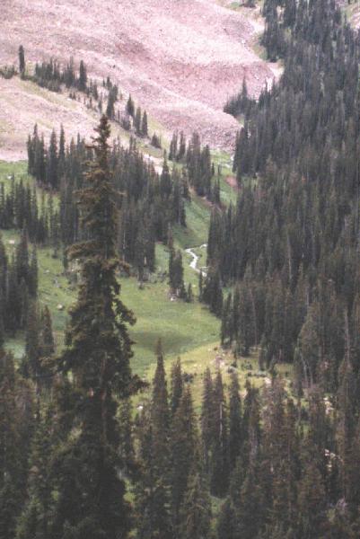
The next landmark is a log bridge in the forest at 3.25 miles is the next "landmark" if for no reason that it is something easy to recognize. In the next set of meadows, there will be streams at miles 4.04 and 4.27. On the first stream, look for fallen trees just up-stream. That is where Marina and I crossed. On the second stream, Marina took a fall, bruising her knee.
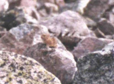
Here is a picture of a Pika we saw on the
way up. I have blown up the image and cropped it, so the image quality
is poor.
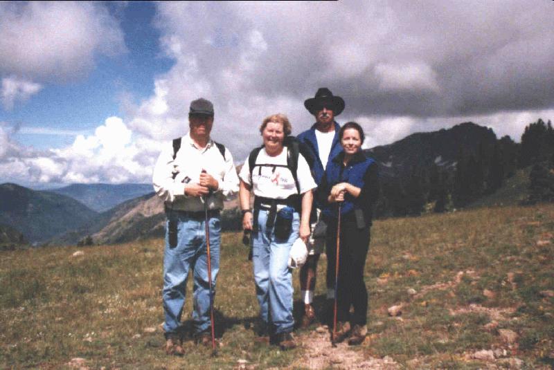
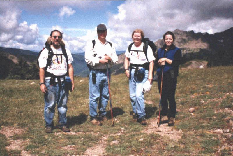
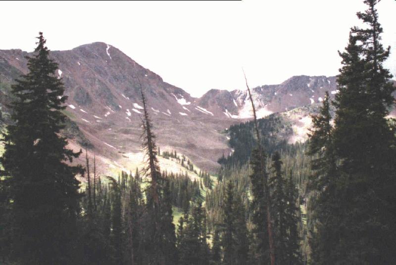
After negotiating the many streams, the trail reached the end of the valley. Looking up, the low spot to your right, just to the left of Red Mountain is the pass that you will eventually cross. To the left is Eccles Pass. On the next hike up to this point, I will get pictures with labels showing where the trail goes. The trail turns towards the left and Eccles as it climbs through an alpine meadow. We got lost here and bush-wacked back towards the Red - Buffalo pass. However, we think that if we had stayed on the trail towards Eccles, we would have reached the junction we were looking for. The junction should be after small hill on your left. The trail will turn sharply right to head back to the Red - Buffalo pass. Once you are underneath the pass, there will be one switch-back to take you to the top. The elevation here is approximately 11725 feet. Here are the obligitory pictures of all of us at the top. First (from left to right) Carl, Marina, John and Erika. Second Don, Carl, Marina & Erika.
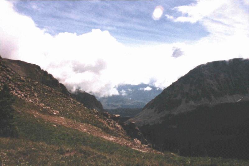
As long as we were at the top, here are some pictures from the top. First looking East at wide angle. Then zooming in, you can see I-70 in the distance.
Then looking West towards Vail.
The trail disappears completely at the top. The topo maps indicate that
you should head left and start a series of switch-backs down the Vail side.
We never found any trail at the top indicating this. There were some cairns
to the right that we believe leads to the summit of Red. If you descend
straight down from the top of the pass, you should see some more cairns
which will lead you to the left and you will pick up the trail again. The
trail will continue descending in a clock-wise or Southerly manner. Looking
to the South, you will see where Gore
Creek is born. As the trail starts to turn West, you cross
through some wetlands (and this is only the first of many). You then come
to the first crossing of Gore Creek. This crossing has no logs or
bridge to help you, but at this point in the creek, it is small enough
that you can cross on the rocks in the stream. From this point until the
next crossing, the creek remains on your right and you descend though wetland
meadows and forests. Numerous small creek crossings will have to be negotiated
This part of the hike was extremely muddy, in fact the muddiest portion
of the hike..
At 7.4 miles you will see a camp-ground on your right. This is a clue
that you will soon arrive at the 2nd and last crossing of Gore
Creek at 7.53 miles.. As you approach this point, keep an eye out across
the creek and you will see a sign. Arriving at the creek you will find
a fairly treacherous crossing. John tried to just wade through, but the
water would have gone over the top of his boots, so he joined us on the
logs spanning the creek. We went across one at a time. What made this difficult
was the first part of the log bridge was a stump that you had to crawl
around. Then the main part of the bridge was three logs, but one of the
logs had 1 inch stubs of branches which made footing treacherous
On the other side, you will see that the sign marks two graves of settlers
from the 1800s. Turn left to keep on descending (versus a climb to Gore
Lake which appears to a 1.4 mile hike from this junction and an elevation
gain of approximately 1200 feet). The trail on this side of the creek is
much drier than on the other side. This is not to say that there is no
mud, there is, but it is a much more pleasant hike. The next waypoint at
8.31 miles is a pond in a meadow, then we put another waypoint in at a
large rock which happened to be in the sun at the time, and looked to be
a good place to catch some rays. The mileage at this point is 9.64, and
the elevation is approximately 9500 feet. Further on, at mileage 9.82 you
cross Deluge Creek. There is a reasonable log bridge for this crossing.
You are fairly close to the end now. Further along you come to the trail junction which leads to Deluge Lake (a 3.64 mile hike and at least a 3000 foot gain in elevation). Then comes the sign marking the border of the Eagle's Nest Wilderness and a short drop brings you to the end of the trail, at 11.46 miles from our house.
This page last updated August 30, 2002