Mayflower Gulch - Gold Hill Ridge Loop - July 12, 2014
 available on this hike.
Distance: 5.3 miles for the loop
Time: 4 hrs - Don was slow going up from the Boston Mine to the ridge
Hikers: Don, Marina
Rating: Moderate
This is known as "Mayflower To Clinton Gulch Loop" in the 8th printing
(2006) of Mary Ellen Guilliland's "The New Summit Hiker"
Bill Linfiield of the Summit Daily News inspired us with pictures from
some of the cabins from the Boston Mine.
This hike, Marina had her iphone, I had my Galaxy S3 and a Garmin
GPSmap 76CS. The Garmin kept loosing signal, neither of the phones
really did. The Garmin would be good for waypoints, but when I needed a
waypoint, I could take a pic with the phone which had the lat/lon
tagging turned on. I may not take the Garmin anymore.
Here is the map and profile from Topo!
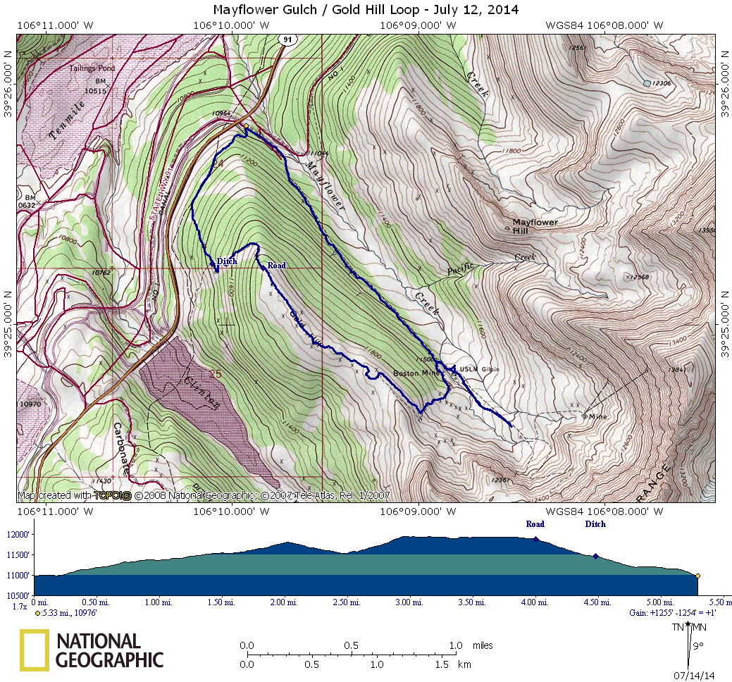
Directions from I-70. Exit I-70 at exit 195.
From the Copper Mountain Stoplight on CO 91, go 5.9 miles up Freemont
Pass. A parking area will be on your left. If you get to the Clinton
Reservoir on your left you went too far and will have to turn around.
The first 1.5 miles of the hike, to tree line and the cabins is in fact
a jeep road. You could take a 4wd that far but there is no parking area
and very tight turn around to head back down. I would say the max
number of cars that can be there would be 2. As it was a weekend and
Bill had pictures from this hike in the SDN, there were a fair number
of hikers on the road.
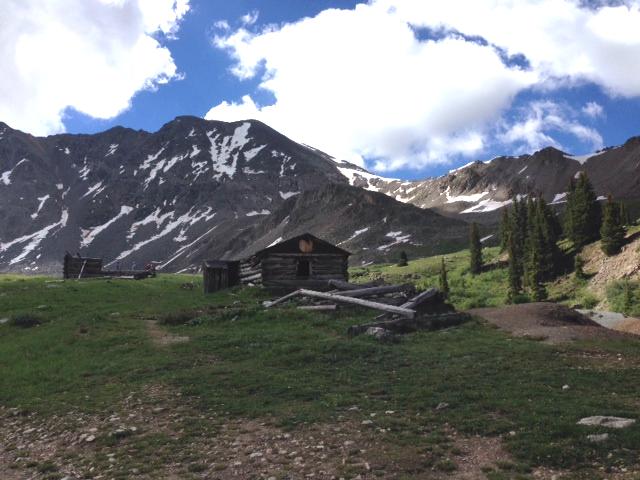
The elevation gain is about 575 feet to this point. The end of the jeep
road will be marked by a cattle gate. The buildings are beyond the
gate. At this point a road goes off to the right and up hill. This is
what will be taken in order to do the loop. We went out another half
mile towards the peaks that make up the amphitheater for more stunning
views then turned around, backtracked back to the road to take us to
the ridge.
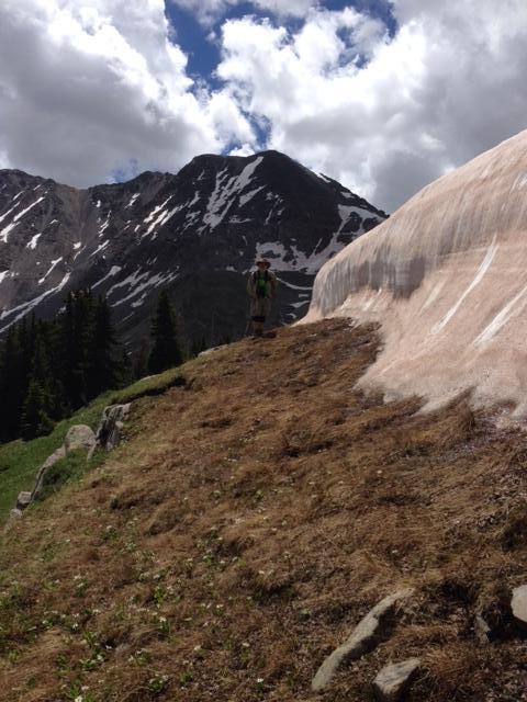
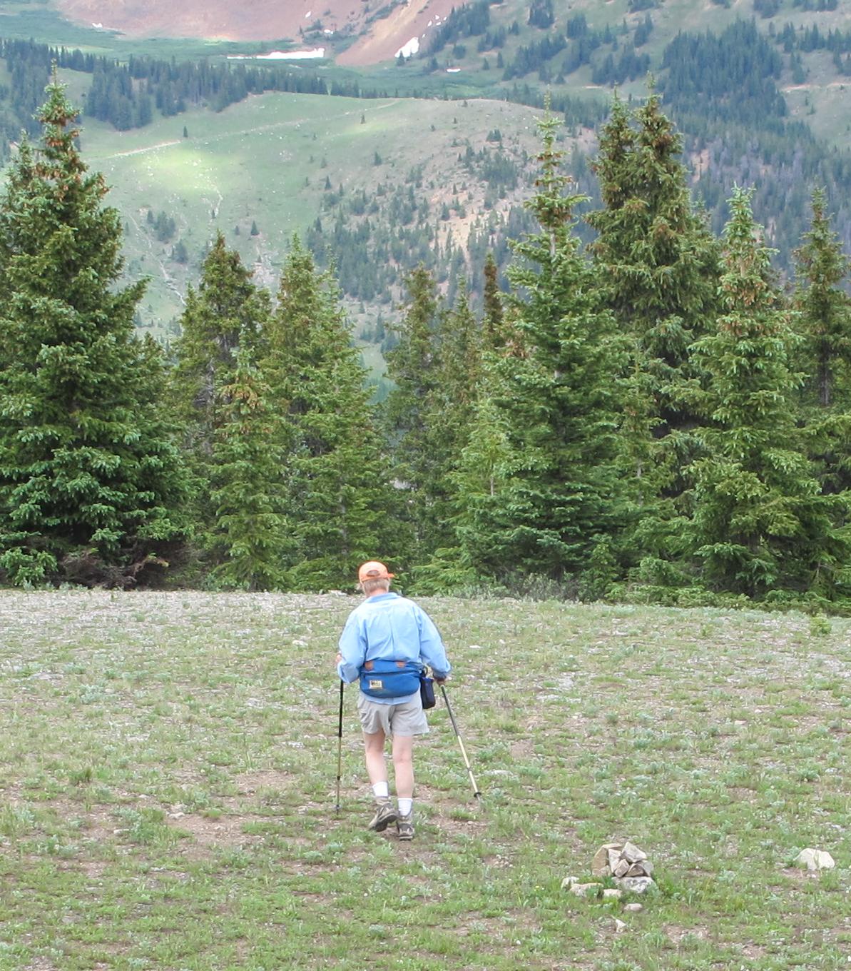
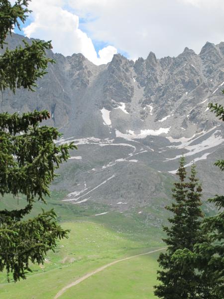
There was a large snow ridge where the trail would have taken us, seen
here at the top right, so we hiked just under the snow ridge until it
ran out then joined the trail running the ridge
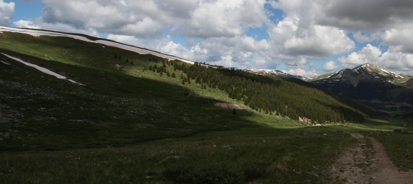
The road itself was the steepest part of the hike and I was moving
really slow. Perhaps carrying an extra lens, extension tubes, neither
of which I used and an extra camera played a part, but I left the
tripod at home and wished I did have it for some of the pictures next
to the mine.
Here is a picture of me next to the snow:
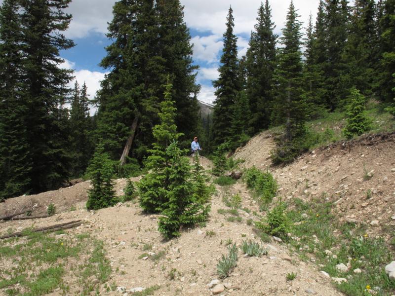
Once on top there is no beaten down trail, instead you need to stay on
the right hand side of the ridge and follow the cairns that are placed
along the way. The spacing on these cairns varies, where you need them
because of a turn they are close together, where the trail is straight
you may not see them at all.
Here is one example:
You can see there is no beaten trail.
As you enter the trees ahead in this photo, on the map you will see a
waypoint marked road. Follow the road down for a half mile. You come to
a 180 degree switch back and if you look on the right hand side of the
road after the switch back, there is a dry ditch. This is now what you
will follow as it leaves the road after a couple hundred yards, again
well marked by the cairns.
Here is where the road has a switchback to the left but the the ditch
goes straight, follow the ditch:
Keep following the cairns for 0.8 miles to
bring you back to the parking lot.
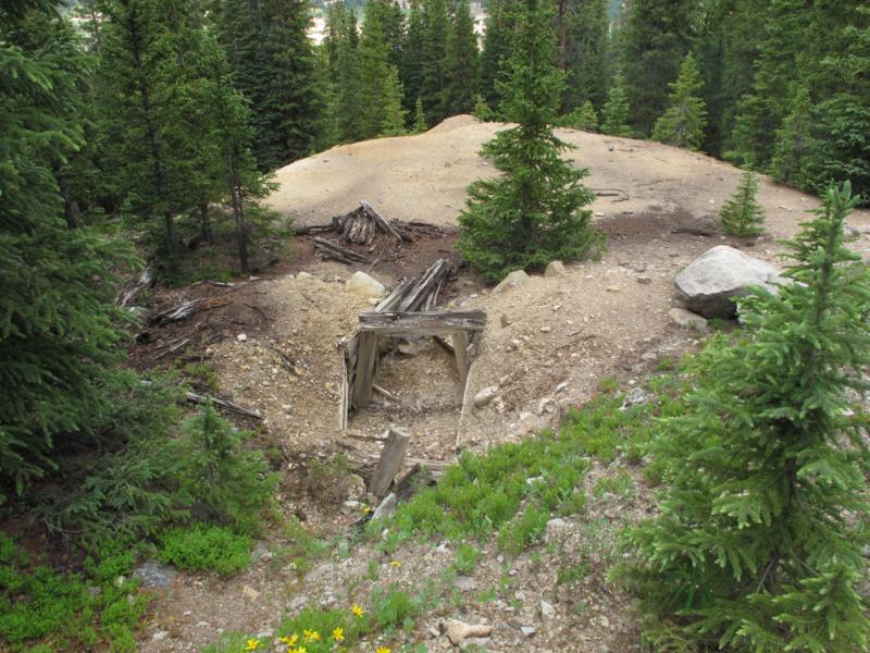
Some mine ruins along the ditch:
Best of the pictures
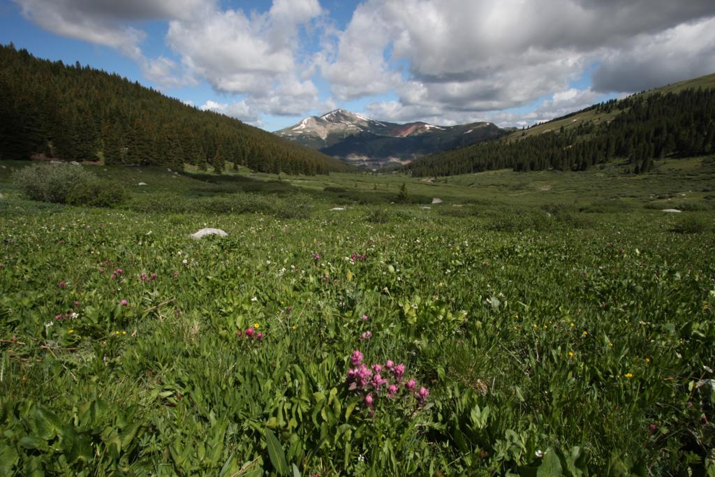
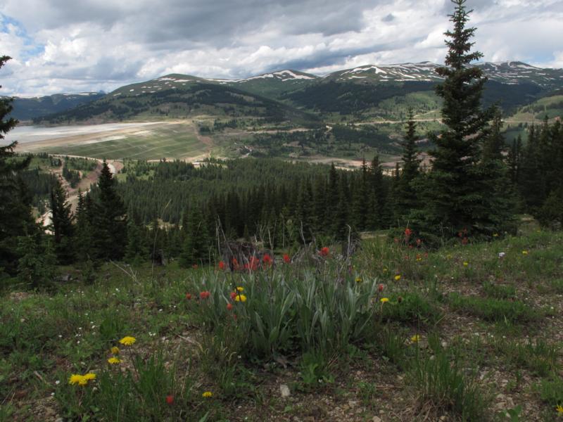
Rosy Paintbrush in the foreground and Jaque's Peak in the distance.
Here I could have used the tripod and cable release.
Canon 40D 10-20mm lens at 12 mm; 1/60 sec; F11.
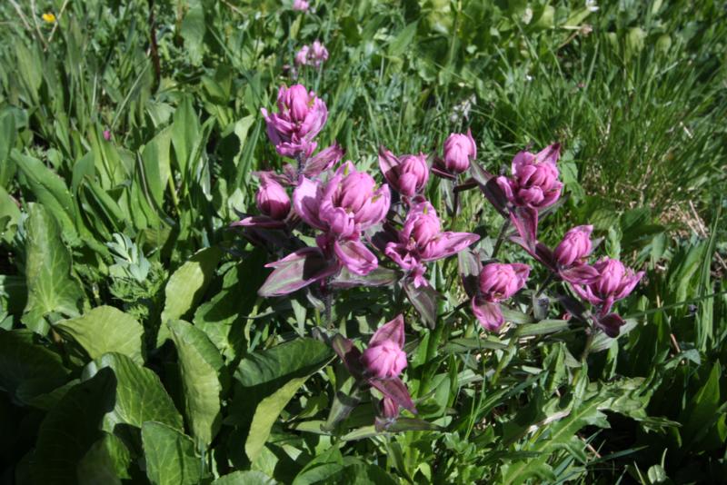
Close up of the Rosy Paintbrush.
Canon 40D 10-20mm lens at 22 mm; 1/50 sec; F11.

From the ridge looking back at the amphitheater.
Also looking back. The road past the cabins is now well below us.
From the beginning of the "ditch looking at the dam holding the tailing
pond:
Feedback to:

Back to Hikes Page
Back to Snowedunder Home
This page last updated July 13, 2014