On Saturday July 1, 2000, Marina, myself and Madalyn Radlauer attempted to climb Buffalo Mountain. We did not reach the summit, but only made it approximately 3/4 of the way. We were worried about thunderstorms coming in. As it turned out, our fears were groundless. The summit, however will have to await another day.
The Summit County Hike Book rates this as Most Difficult, and I have to agree. There are two types of ratings that the book should employ, one based mostly on distance, and one on degree of technical difficulty. This hike is a short hike, but is by far the most technically demanding of any of the hikes we have done so far.
If you look at a picture of Buffalo from say Dillon (and I will supply this picture at some point in the future), you will see two large avalanche slides. The largest on the left and a slightly smaller slide on the right. The hike goes straight (and I do mean straight) up the right hand slide.
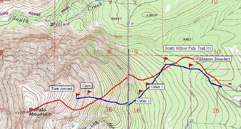
Here is a topo map using information from our GPS showing the route:
In this map, I am showing two routes. The red route is my reading of what is drawn in the Summit Hike book. The blue is my trace of what the GPS said we did. The blue route goes up the fall line, while the red route takes a gentler approach. We did not see any indication of the red route either going up or down.
Here is a picture of buffalo from Keystone. I have drawn in what I believe
the route was:
You can see from the map that the blue route does indeed go through the slide area.
While we were hiking, we did see a Summit County Local almost running up (and we saw him coming down as well). His technique was to go up with hike/run with two ski poles. They were not anything special, just ordinary alpine poles. Based on the steep-ness and slipperiness of the slope, I think that our next attempt we will use alpine poles as well.
Hike Details:
We started off at around 8 am from the trail head. The elevation is approximately 9760. The trail head is right on the road, and there is a small parking area on the other side of the road from the trail head. There are two trails at the trail head, you will want the left hand trail. The right hand one looks like it leads to one of the condominiums that surround the road.
At .35 miles and 9957' elevation, you enter the Eagles Nest Wilderness.
There is a fairly new sign indicating the boundary. At 0.60 miles you come
upon a trail junction.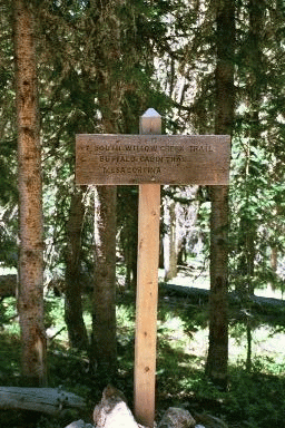
If you turn right, you will head towards the Gore Trail, and meet it
at the South Fork of Willow Creek. Our hike, however goes to the left.
These are the only choices, there is no straight ahead. This point was
reached in 15 minutes, and the elevation is now about 10036 feet.
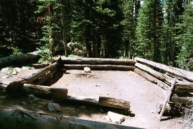
The first of two cabins is reached at 0.88 miles. The book only speaks of one cabin, but we saw two. Leaving this cabin, the trail crosses a creek. This was the only water we saw on the hike. The second cabin is reached at 0.98 miles and 10,375 feet in elevation, and 38 minutes of hiking.
Here is the 2nd cabin:
Continuing up the mountain, you start to cross a lot of downed trees, and the surrounding forest is full of old downed trees. I surmise that this is where the avalanche stopped. You soon reach an area of much younger and shorter trees. The trail at this point goes straight up the fall line. Up to this point, the hike would be rated as easy. From here on out it is rated most difficult. There is not much to say, except that we adopted a technique of going 50 steps and resting. The leader would count up to 50 and call a halt. We did not worry about how far we were going. As we approached the point that trees stopped and only bush like Spruce remained, we went from 50 steps to 40. A skree field appeared on our right and we noticed the first cairn. I am sure that there were more cairns, but we did not reach any of them. This was at 1.54 miles and an elevation of 11,473 feet.
We finally stopped at what the local said was 3/4 of the distance and most of the steep part after 3 hours and 45 minutes of hiking. The topo says we hiked 1.67 miles (although the GPS said only 1.07 miles). The elevation was approximately 11,800 to 11,900 feet.
Here are some pictures from that spot:
First of Maddie:

Note the steepness of the slope
Then of Marina:
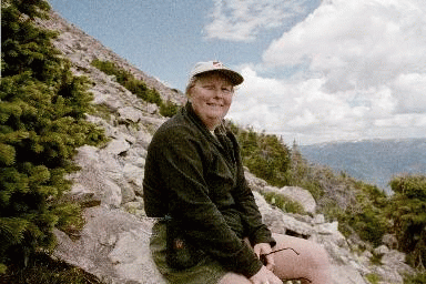
Also note how steep.
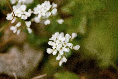
Finally some flowers:
We ate lunch and started down, reaching the car in just under 3 hours,
versus 4 hours up. The descent was very slow. Maddie did not have a good
pair of boots, and had trouble keeping her footing. A good pair of boots
is a must on this trip.